Search Results for 'Balls Bridge'
5 results found.
The canal
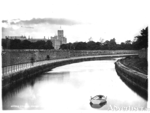
In 1872, SU Roberts, the Galway County Surveyor, wrote: “The lower lake empties its waters through a delta by three visible outlets: the natural and original shallow, tortuous and rocky Corrib River, navigable for only very small craft and row-boats on the west; the Mionloch Creek, a small stream, on the east and now nearly filled up; and through the boggy island covered with sedge between these two, by means of the “Friar’s Cut”, a canal of about three-quarters of a mile in length, fifty feet wide and twelve deep through the main stream passes. Besides these three streamways, there is a subterranean communication through the cavernous limestone, by means of ‘swallow holes’ near Tír Oileáin on the eastern shore which formerly carried off a large portion of the surplus waters of the lake, and discharged them into the sea near Oranmore”.
George Chambers’ photographic archive
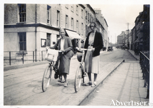
George Chambers was born in England in 1873. He lived at Temple Fortune Lane in Middlesex. He travelled extensively and this included several trips to Ireland. In 1929, he toured parts of West Cork and Wicklow; in 1931, he visited Galway city and the Aran Islands and on subsequent trips he went to the Blasket Islands, to Achill and Clare Islands, and to various other islands off the coast of Donegal.
The construction of the Claddagh Basin
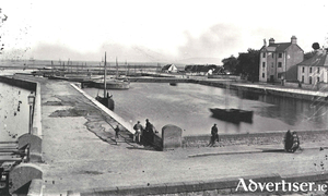
On January 1, 1848, Samuel U Roberts was appointed district engineer of the Districts of Lough Corrib. He spent the early part of that year making necessary preparations and arrangements and started navigational works in Galway on March 8, having taken possession of some of the lands required for the Eglinton Canal.
The West Bridge, a brief history of the early years
The city of Galway was known in ancient times as ‘Streamstown’ because the Galway River divided into several small waterways in addition to the main river. The river was much more spread out then and was fordable in some places. The city was placed on the east side of the river, which acted as protection against the Irish families displaced by the Norman settlers who took over the area in the early 13th century. The walls of the city provided protection on the east and north side of the city and the various gates allowed access. The river was a barrier to trade with Iar-Chonnacht and so the merchant families began to feel the need to build a bridge to help expand trade, it would provide access to customers from the west, and also allow them to bring in their produce, fruit, vegetables, meat, hay, etc, to the various markets in town.
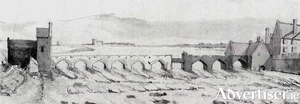
Balls Bridge, 1685
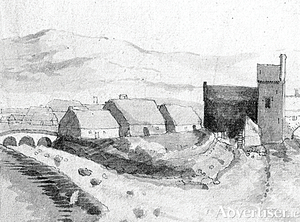
This drawing is of a detail from “A Prospect of Galway” drawn by Thomas Phillips in 1685. It shows the southern end of the middle suburb with Balls Bridge on the left, and the bit of an arch you can see on the far right was part of the West Bridge. Balls Bridge is the bridge over what is now the canal between Upper and Lower Dominick Street, and the buildings we are looking at would be the backs of Lower Dominick Street as seen roughly from across the road from where the Fisheries Tower is today. The West Bridge is where O’Brien’s Bridge is today.

